Travel Info
- Distance
- ~ 261 km / 162 miles 5.5 hours without stopping
- Suggested Trip Time
- 1-2 Days
STOPS ON THIS LEG OF THE GOLD RUSH TRAIL
Take the road less travelled TO BARKERVILLE cutting through the cariboo mountains and an inland temperate rainforest
Already planning your Gold Rush Trail trip for next year? Looking for an adventure on the road less travelled? Plan a trip on the Gold Rush Circle Route linking Likely and Barkerville Historic Town & Park. With the discovery of gold in 1858/1859 in the Horsefly and Likely areas, prospectors from all over the globe rushed to the boom towns of Harper’s Camp, Quesnel Forks, Keithley Creek and Cedar City. Large populations of Chinese settled where Europeans had been prospecting for gold and once the gold fever abated, huge scale hydraulic extraction facilities, like the Bullion Mine in Likely replaced many of the small placer mines. At Quesnelle Forks, which sits at the confluence of the Quesnel and Cariboo Rivers, abandoned cabins still remain on what was originally a traditional indigenous gathering area.
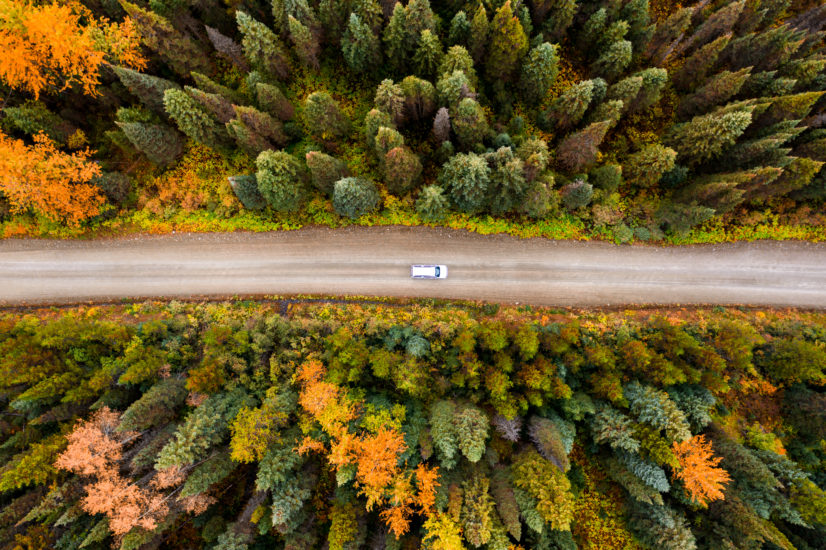
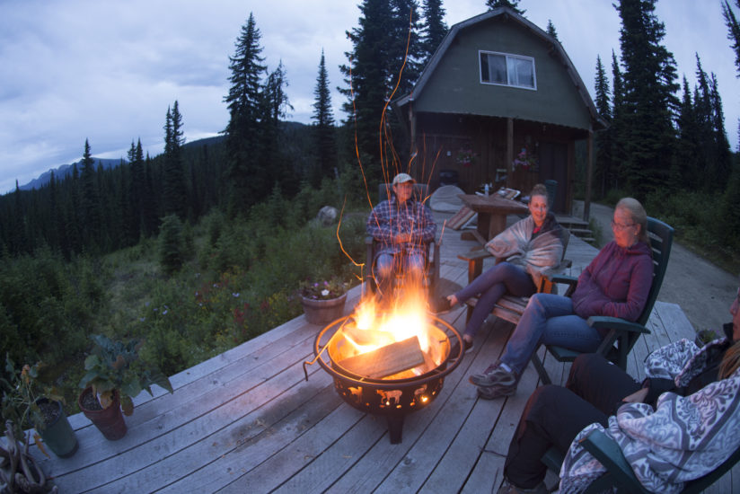
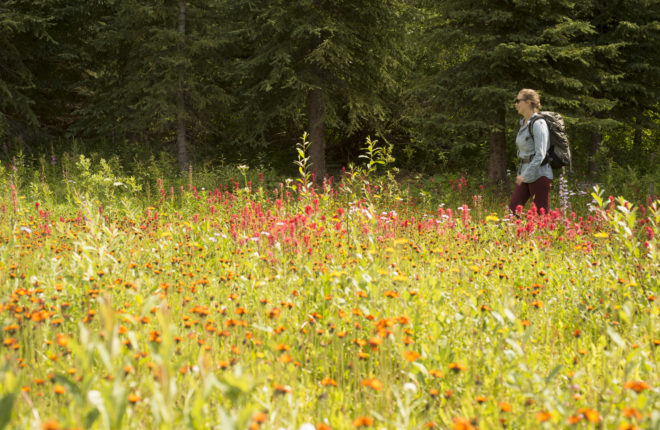
This seasonal gravel forestry road (open May to September) winds through the Cariboo Mountains, past stunning waterfalls, an inland temperate rainforest, pristine lakes and the Cariboo River in an alluring backcountry landscape of sub-alpine meadows. Leading you to Barkerville Historic Town & Park, the Gold Rush Circle Route also features opportunities to explore Gold Rush history and paddle on glacier fed lakes, backdropped by snow-covered mountain ridges. For one of the most spectacular sights of the trip, hike up Cameron Ridge for panoramic views of the Cariboo Mountains and stay the night in a cozy cabin at Cameron Ridge Bungalows.
The Likely-Barkerville Back Road (8400 Road) at one time was only possible with a 4×4 vehicle but now, with improvements, it is a decent gravel road that most 2-wheel drive vehicles in proper operating condition can navigate. Logging trucks and heavy mining equipment use these roads 12 months of the year so exercise caution at all times.
This route takes approximately 4 hours (Wells to Likely) depending on how many stops are made. Follow Keithley Creek Road and turn right at the Barkerville sign, cross the Cariboo River and turn left onto 8400 Road. Stop at Ladies Creek Recreation site for a close up look at Cariboo Lake. There is a hiking trail to Cameron Ridge. Check the Back Road Brochure for further information. The road turns into the 3100 Road on the Quesnel side. The falls of Ghost Lake turn into the Matthew River and are spectacular; definitely not to be missed. This is a summer road only so confirm conditions before proceeding, usually open the end of June through September. If you’re lucky.
The road is usually open to tourist traffic from July 1st to the end of September. To be safe, please always check road conditions and due to lack of internet and cell phone range in this area. It is advisable to pick up a brochure/map before you depart on this back road adventure; these can be found at the Cedar Creek Tourism Center in Likely. Remember to fill up with petrol and supplies before your trip. Download this Back Road to Barkerville Brochure and Map before you embark on your journey.
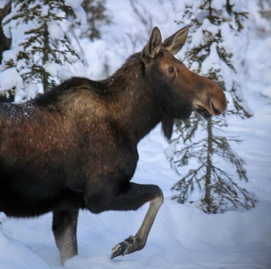
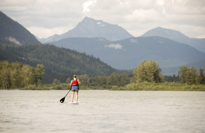
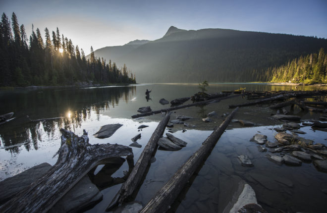
Likely is located on the original Gold Rush Trail at the west end of Quesnel Lake, the deepest fjord-lake in North America. This area played a significant role in the Cariboo Gold Rush of 1859 when rough-edged boom towns like Quesnelle Forks, Cedar City, and Keithley Creek had overnight populations in the thousands. Today Likely is the gateway to the stunning Cariboo Mountains, Quesnel Lake and B.C.’s inland rain forest with distinct flora and fauna unique to the area. The area surrounding the lake is known for grizzly and black bears, moose, mountain caribou, mountain goats, wolves and wolverines. More than 250 species of birds have been noted in this region in the foothills of the Cariboo Mountains. Likely is the perfect place to get off the beaten path and experience year-round adventure: fishing, kayaking, wilderness camping, mountain biking, whitewater kayaking, hiking, snowmobiling, snowshoeing and guided eco-tours, including bear and wildlife viewing.
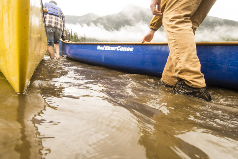
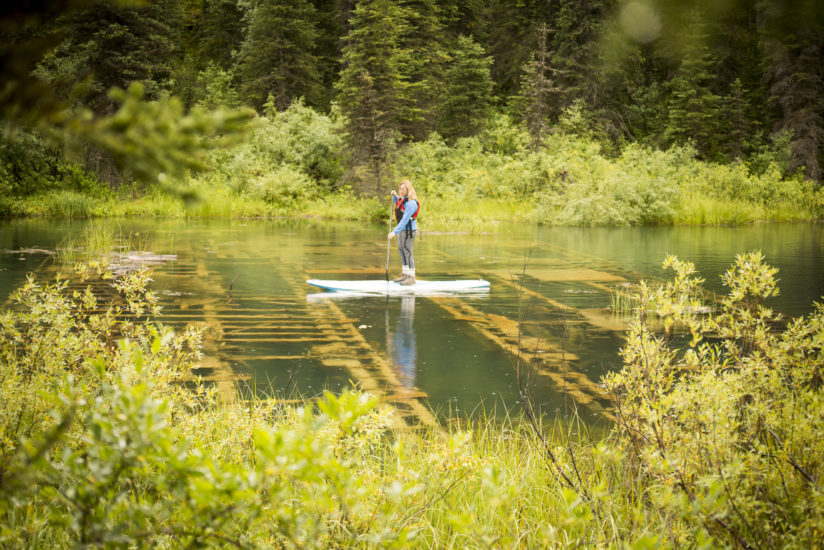
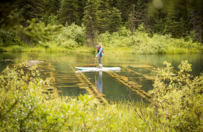
- Visit Quesnel Lake, east of Likely, BC, which is considered the world’s deepest fjord lake and the deepest lake in BC with a maximum depth of 511m. Due to the remote location, Quesnel lake offers the ability to fish right from shore and along tributary streams, or to explore the lake by boat, kayak, canoe, or paddleboard during the summer months.
- While in the area, be sure to visit the Historic Bullion Pit and Quesnelle Forks to learn more about gold rush history in the area.
- Cedar Point Provincial Park is a scenic park nestled in a tall stand of ancient cedar trees next to Quesnel Lake. The park offers a boat launch, day use and camping. In the 1850s, Cedar Point Park was a rendezvous point for the Hudson’s Bay Company fur brigade. The Cedar City Museum located in the park offers maps and information on day trips and attractions of the area from peak season June to September.
- Book a fly fishing trip at the historic Northern Lights Lodge. This unique BC fly fishing lodge offers unforgettable guided fly fishing on four pristine wilderness rivers in the Cariboo Mountains.
- The best place to see grizzlies is by the river. Ecotours-BC is situated on the sublime Quesnel River, a go-to bear habitat in the summer and fall during the salmon runs. The Pyna-tee-ah Lodge is home base for daily explorations with well-known guides including the “Bear Whisperer.” Guides follow the bears throughout the seasons and their knowledge of the bear’s ecology and local wildlife is immense.
- Likely is also is a great leaping off point to explore the “Gold Rush Circle Route” also known as the backroad to Barkerville Historic Town & Park. You will travel through historic areas of the original Gold Rush Trail along the foothills of the Cariboo Mountains. Be sure to stock up on all your supplies and check road conditions in Likely before you embark on your backcountry adventures.
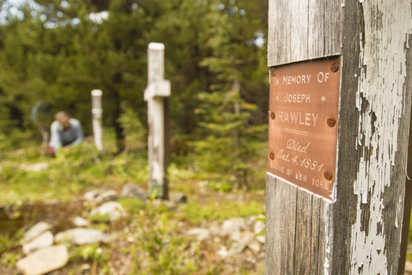
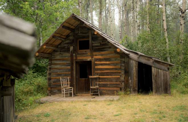
In the early 1860s, gold fever was rampant at the confluence of the Quesnel and Cariboo Rivers. ‘The Forks’ was established in 1859 and quickly became a rowdy camp and supply hub for the thousands of transient miners. After the gold prospectors moved farther north, the community’s key location made it a major entryway to the goldfields and it remained a busy hub. When the Cariboo Wagon Road was completed in 1865 the community was bypassed and fell into decline. By the mid-1870s, most of the residents had left, though a thriving community of Chinese prospectors and merchants temporarily remained to support a widely dispersed mining community. Today, Quesnelle Forks is a ghost town situated 13 km/9 mi northwest of Likely by dirt road. There are no entrance fees or employees, no souvenir shops or cafes, you can simply enjoy the compelling glimpses and fragments of the past.
- Visitors can wander through original log cabins, a heritage graveyard, a campground, trails and the Quesnel River frontage.
- Stroll through the historic cemetery and check out the old graves.
- Walk the low mobility trail which goes along the river and through the heritage village. There are even two wheelchair-accessible outhouses on the site.
- Camp at the nearby Rec Site located right on at the confluence of the Quesnel and Cariboo Rivers and adjacent to the ghost town.
- Self-guided kayaking and rafting have become popular on the Cariboo and Quesnel Rivers. If you are a paddler check out the UnLikley Paddle Group for inspiration and insider knowledge.
One of the first big strikes in the Cariboo was made in 1860, when prospectors found gold at Keithley Creek. It was named after one of the prospectors William R. Keithley, aka ‘Doc’, who came from the California gold fields in the 1860s. Production from Keithley Creek was estimated at 275,000 ounces. Nearby Antler Creek had gold so close to the surface that in some cases you didn’t even have to dig for it. A miner could make at least $40 a day, and sometimes up to $300 a day. Some prospectors had been known to get $75 or $100 dollars worth of gold in a single pan (Royal BC Museum). Other people, like Veith and Borland, set up a ranch and a town grew, supplying food and goods for the miners in the area. Nearby is Yanks Peak which was named after Bill Luce, a well-known American Miner and is popular with snowmobile clubs. Keithley Creek and the Yanks Peak trailhead can be accessed via Likely or Wells/Barkerville on a seasonal forestry road.
- Visit the Keithley Creek cemetery and library (smallest library in the Cariboo).
- Take a guided tour to this area on a fascinating Gold Rush Tour with Ecotours-BC.
- If you look to your right as you drive down the road from Likely you can see the rocks piled by the Chinese miners.
- A Yanks Peak is well worth the time and effort but is accessible only by ATVs, snowmobiles or on foot. Enjoy the awe-inspiring scenery, of old mines, wildlife and alpine meadows that eventually lead to Barkerville Historic Town & Park. The Wells Snowmobile Club is a good resource to find more information about the trail.
Cariboo Lake is situated about 24 km/14.9 mi north of Likely on the Keithley Creek Rd. It is large lake that is actually a wide swollen part of the Cariboo River. The beautiful lake offers spectacular views of the Cariboo Mountains and contains wild stock Rainbows, Lake Char, Kokanee and Dolly Varden. Be sure to always call or stop in at the Likely Tourist Information located within the Cedar Point Park and Campground to check the road conditions before you depart on your trip.
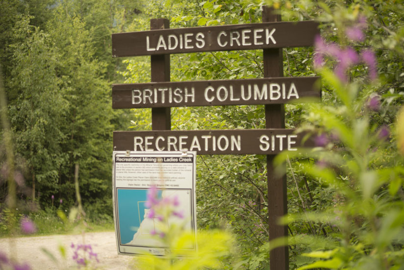
- Camping is available at the stunning Ladies Creek Rec Site above the eastern shore of the lake. This is the only campsite along Cariboo Lake, it is a medium size site with heavy use during hunting season, but a great spot to explore the Cariboo gold rush area and Ghost Lake. Boat launch access is steep and long, 4×4 may be required.
- Browntop Mountain Trail is a short hiking trail that takes you to sub alpine areas south of Cariboo Lake. Heading north: from Keithley Creek Road turn right at the Barkerville sign, cross the Cariboo River and turn left onto the 8400 Road. Proceed 4.1 km on the 8400 Road to the C Road. Turn right and continue for 7.4 km to the trailhead. The road to the trailhead has grown in and may not be accessible by vehicle.
Cameron Ridge truly is a paradise, located in the heart of the Cariboo Mountains amongst the pines and spruce along a seasonal gravel road. The abundance of flowers, the diversity of trees, and the sparkling glacier waters of the many creeks, streams, and lakes are all there for you to enjoy. Be sure to always call or stop in at the Likely Tourist Information located within the Cedar Point Park and Campground to check the road conditions before you depart on your trip.
- Go on a hike, starting along the Gold Rush Circle Route at the SITE 5 sign on the 8400 mileage marker. The Cameron Ridge hiking trail enters subalpine meadow supporting a chain of small lakes and is breathtakingly beautiful. The trail embraces the wildlife-rich watershed of the Penfold Valley, with ancient cedar and spruce forests. The main hike is the 14 km Cameron Ridge Trail, which climbs along Cameron Ridge to the Cariboo Mountains Lookout. It is an easy hike through stunning sub-alpine meadows ringed by snow-capped peaks that lead to a stunning overlook of the north arm of Quesnel Lake.
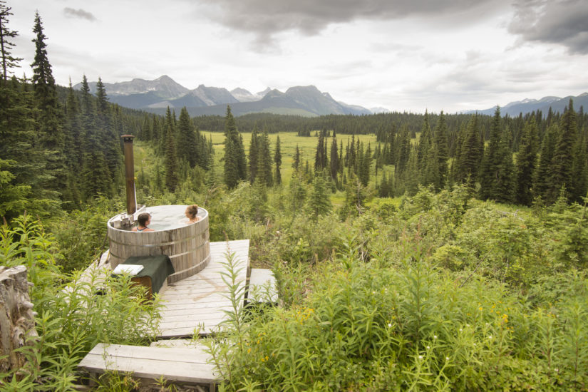
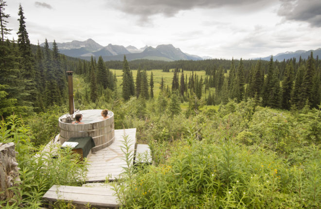
- If you need a place to stay, you can spend your night at the Cameron Ridge Bungalows or you can inquire about a guided tour. They offer exclusive cabin rentals, trail rides, hiking trips, wildlife viewing, and canoe excursions on haunting Ghost Lake. And not to forget, a fire-warmed hot tub, overlooking the valley and mountains and delicious home-cooked meals.
- Have your camera handy for the many glaciers, the old growth forests, the abundance of flowers, the marvelous scenery, the assortment of wildlife, including grizzly, black bear, moose, and mountain goats.
Cariboo Mountains Provincial Park is true wilderness, dominated by rocky peaks, glaciers and densely forested valleys featuring plenty of lakes and lush wetlands. The park is situated in the interior wet belt between Bowron Lake and Wells Gray Provincial Parks. These parks now create one continuous protected area in the Cariboo Mountains that is over 760,000 hectares in size. This undeveloped park is located northeast of Likely and east of Quesnel. Be sure to always check the road conditions before you depart on your trip. Bears and cougars are also present in the park so be prepared for wildlife encounters; be very cautious and do not approach closely.
- Vehicle access camping is available at Ghost Lake and this small, remote site features views down the lake and up into the surrounding mountains, and is adjacent to the scenic Matthew River Falls. Another route to Ghost Lake is via Likely (about 90 km/56 mi). The 8400 Road (Cariboo Lake Road) from Likely leads north past Cariboo Lake and eventually connects up with the 3100 Road. Follow this to the Ghost Lake turnoff (signed), turn right and drive another 4 km to the campsite. The small user-maintained campground offers five campsites, a parking lot, an information kiosk and a pit toilet.
- There is an unmarked trail that goes from the campground to the lakeshore where you can carry a canoe or kayak and launch to by hand. Once boating or fishing in the lake you’ll find some incredible views of the Cariboo Mountains
- Ghost Lake Falls is near the entrance to the campground just before the turnoff for the Cunningham-Matthew FSR while you go across a bridge on the Ghost Main.
Whiskey Flats was the site of a large early-century dredge operation near Wells and Barkerville. When standing on the shore, you can see the remains of the Kafue Dredge boat, a floating bucket dredge owned by the Kafue Copper Development Company, a Service Corporation of London England, which operated in the 1920’s close to Barkerville. Today there is a small three-unit rec site that is a perfect base for those wishing to explore the back roads of Barkerville and Yanks Peak. Be sure to always call or stop in at the Likely Tourist Information located within the Cedar Point Park and Campground to check the road conditions before you depart on your trip.
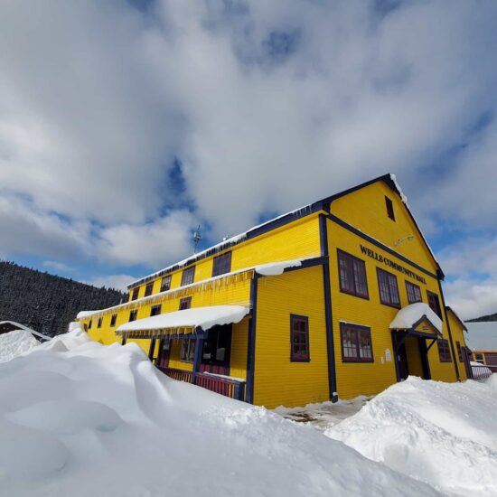
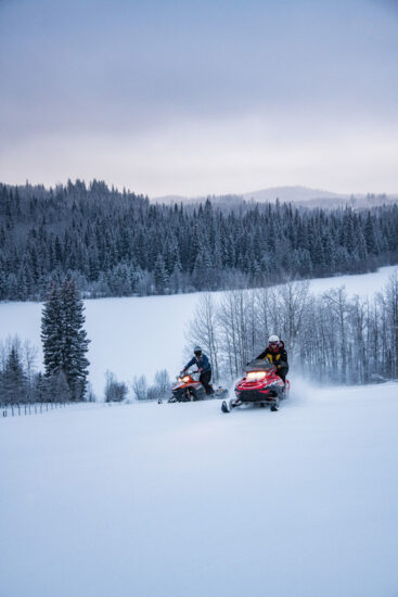
The mountain town of Wells was built as a company town for Fred Wells’ Gold Quartz Mine when the promise of more gold gave many an opportunity to escape the great depression in 1927 with the population reaching over 4000 people in the 1940s. With fewer than 300 year-round residents in Wells today, many of its heritage buildings have been restored, including the Wells Hotel and the Sunset Theatre, where you can enjoy live music, live theatre and concerts all through the summer. Other architectural landmarks sport rainbow colours in a nod to the town’s vibrant arts scene. Wells is a small but diverse town nestled in the mountains and is a centre for artists and outdoors enthusiasts. During all four seasons, outdoor enthusiasts can enjoy the excellent trail systems available for mountain biking, hiking, cross-country skiing, snowmobiling and ATV-ing or head to nearby Troll Mountain for some downhill skiing.
- Island Mountain Arts is a celebrated art school, offering classes in the visual, literary and performing arts. In addition, they host the popular ArtsWells Festival of All Things Art (held the first weekend in August). Also, be sure to check out the Sunset Theatre’s programming and events throughout the year.
- Take a stroll around town and feel the rich past of an authentic gold rush town. Visit shops and galleries like the Frog on the Bog featuring the creative work of local artists and artisans.
- Barkerville is located just 5 km/ 3.1 mi east of Wells, therefore, many travellers combine a trip to Wells with a visit to Barkerville Historic Town & Park. The extraordinary historic town of Barkerville is a living history of BC’s golden beginnings.
- The beautiful Bowron Lake chain is only a short distance from Wells and offers fantastic opportunities for people to kayak, canoe and camp. There is a Provincial Park, as well as other places to stay, like the Bowron Lake Lodge or you can find canoe rentals at Bowron Lake Canoe Rentals.
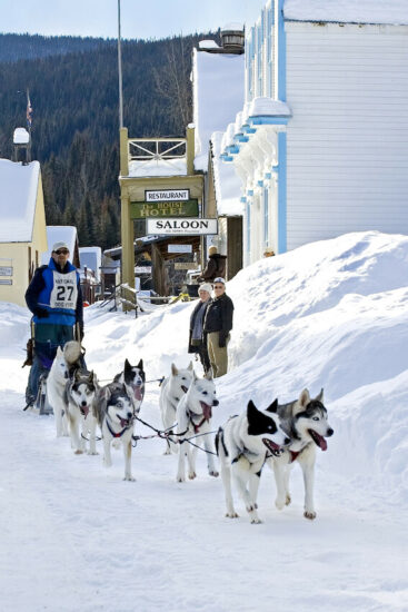
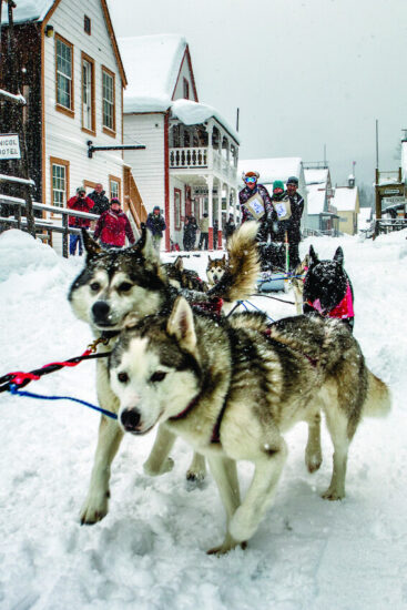
- During the winter, dog sledding and skijoring is very popular in Wells and attracts people from across the world to take in the famous Gold Rush Trail Sled Dog Mail Run. Join the locals and head out with snowshoes or skis.
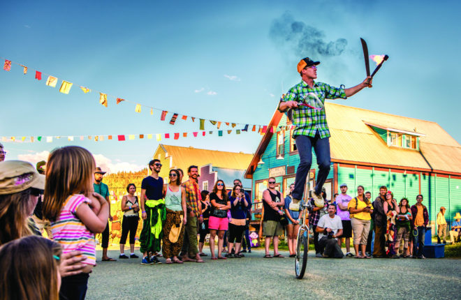
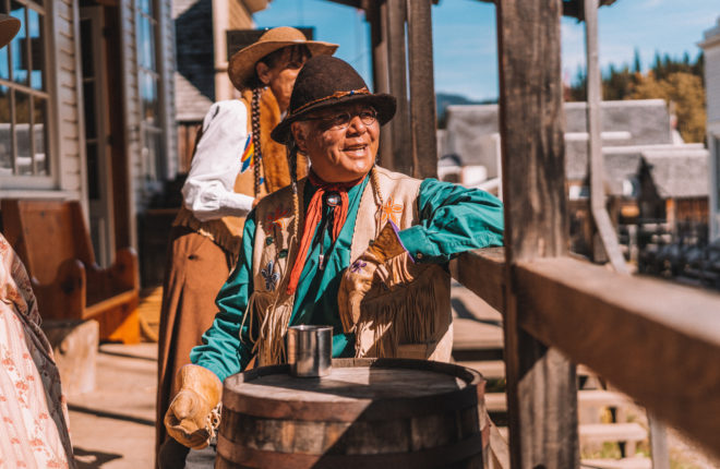
You have reached the El Dorado of the gold rush, where on August 17, 1862 Billy Barker’s legendary gold strike on Williams Creek triggered a multi-billion-dollar industrial revolution that literally built and shaped British Columbia. Gold fever spread like an epidemic when news of the strike filtered out, bringing fortune seekers from around the world into the remote wilderness. Now a Canadian National Historic Site, Barkerville Historic Town & Park is British Columbia’s best known heritage destination and the largest living-history museum in western North America, where exciting seasonal events and fun-filled daily activities await. Barkerville is located in the shared territory of seven Indigenous Nations and includes 125 restored buildings on display with knowledgeable historic interpreters guiding you through Barkerville’s rich history through storytelling, activities, interactive lessons, theatrical performances, gold panning, stagecoach rides and more! It definitely takes more than one day to get the full experience at Barkerville. Be sure to check out their website for all the exciting programming, seasonal events and special programming.
- Absorb an in-depth understanding of the gold rush history, Barkerville, and the colourful characters of years past by attending one of the enlightening and entertaining town tours, hosted by Barkerville’s historical interpreters. The tour is highly recommended for first-time visitors.
- Take in daily programming that shares the diverse gold rush stories and history from multiple perspectives. From the Confederation Rally, an authentic classroom session, cemetery tour, courthouse trials, Chinese cultural sessions, indigenous storytelling, blacksmith and printing press demonstrations, shows at the Theatre Royal, mining and waterwheel presentations you will leave enriched from all of the authentic and diverse programming Barkerville offers.
- Participate in an Indigenous Cultural session and learn more about the indigenous stories and history in the area.
- Enjoy a fascinating tour of one of Canada’s oldest Chinatowns where you can learn about the life of Chinese miners and merchants in Barkerville and how their culture was maintained and adapted to the rugged land of the Cariboo.
- Stay in one of Barkerville’s cozy year-round accommodations that will take you back in time to the hey-day of the Cariboo Gold Rush.
- In the winter, experience a host of fun, family-friendly events, including an Olde-Fashioned Christmas or take in the historic Gold Rush Trail Sled Dog Mail Run.
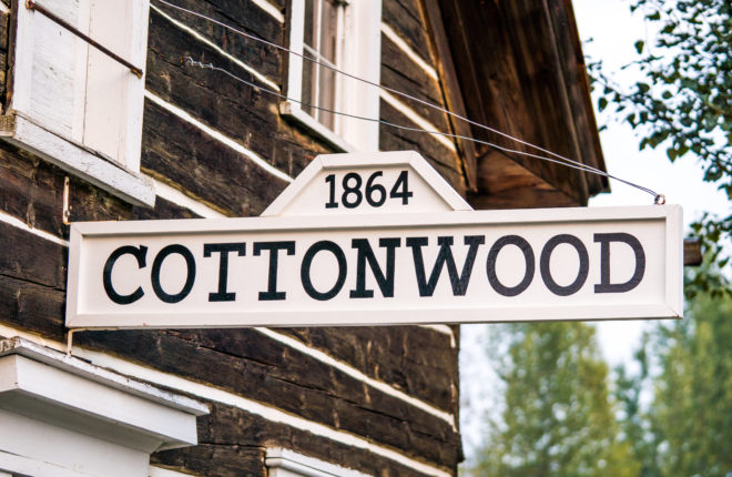
Cottonwood is located in the northern Cariboo Plateau, 8 km/5 mi northwest of Coldspring House, which is at the beginning of the Cottonwood River (at the confluence of the Swift River and Lightning Creek – one of the more renowned creeks during the Cariboo Gold Rush). Located on Highway 26, between Quesnel and Barkerville Historic Town & Park, Cottonwood House Historic Site is one of the last few remaining Cariboo gold rush era roadhouses. It was built in the 1860s to offer accommodation, meals and provisions to miners and travellers on their journey along the Cariboo Waggon Road and became one of the most famous roadhouses, known as a stopping place of high quality. Today, this wheelchair-accessible provincial historic site will allow you to experience firsthand over 75 years of the Boyd family history and the many features this unique heritage site has to offer for those wanting to explore and experience the Gold Rush Trail and its rich history.
- Cottonwood House was a fully functioning farm with horses, chickens, rabbits, and sheep. The site features a variety of original and antique farming equipment for guests to explore and learn about historical farming techniques.
- Tour the many heritage buildings on site, including the Double Barn, built in 1895, and the General Store, originally built as a warehouse in 1888. Other heritage structures include the Gift and Candy Shop, Horse Barn, a Guest House and Root Cellar.
- Enjoy the use of the 3-kilometre wheelchair-accessible trail system. With varying lengths and degrees of accessibility, these trails will allow you to experience all aspects of this 26-acre site.