Travel Info
- Distance
- ~ 96 km / 60 miles Highway 1 and Highway 97 N
- Suggested Trip Time
- 1-2 Days
STOPS ON THIS LEG OF THE GOLD RUSH TRAIL
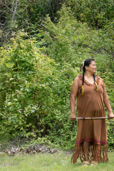
The Nlaka’pamux PEOPLE living along the Thompson relied on the bounty of fish to sustain their communities.
We must remember long before the discovery of Gold, the Nlaka’pamux (ing-khla-kap-muh) people inhabited the Fraser Canyon area, all the way along the Thompson River to Ashcroft. As gold started to become more difficult to find in the mid-1800s, adventurous miners began to work their way up the precipitous walls of the Fraser Canyon. Having reached the mouth of the Thompson River in Lytton, they discovered even coarser gold below the canyon walls. This confirmed the prospectors’ suspicions that there existed an area that contained coarser gold further north, but the miners soon realised that gold in the Thompson was not profitable and moved north to the Cariboo. The famous Cariboo Waggon Road followed along the sagebrush filled bluffs of the Thompson River, with major stopping points at the Ashcroft Manor and Historic Hat Creek Roadhouse. In 1863 Thomas Spence, the famous road builder finished the Cariboo Highway by replacing the ferry at Spences Bridge with a wooden toll bridge across the rushing Thompson River.
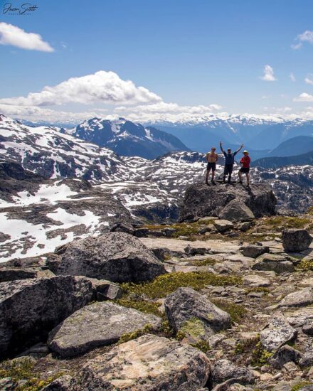
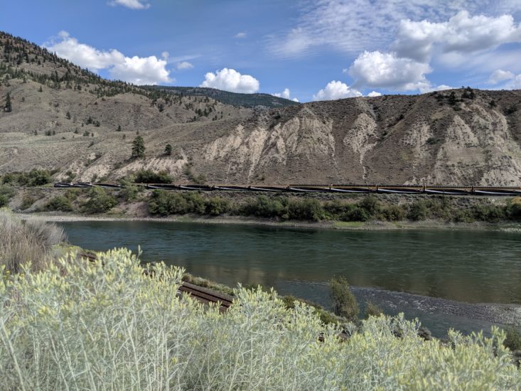
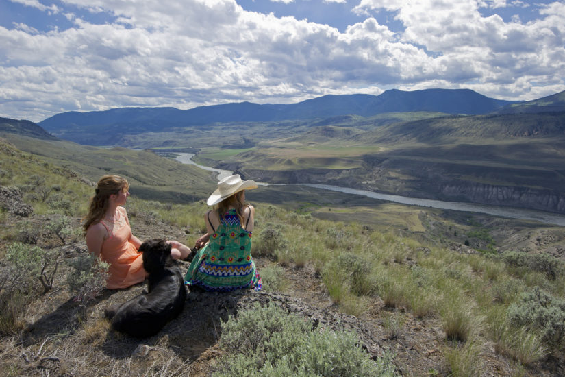
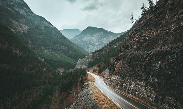
This section of the Gold Rush Trail sees a major shift in the landscape. As you leave the sweeping mountain and river views of the Fraser Canyon, you will travel along the Thompson River where sagebrush, grasslands and a dry climate begin to take over. This is a section of the Gold Rush Trail with unique geological variations, desert hillsides, abundant with wildlife, and rich history. This journey is jam-packed with stops along the way; keep an eye out for bighorn sheep as they love this stretch of road.
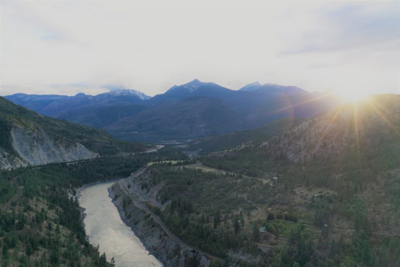
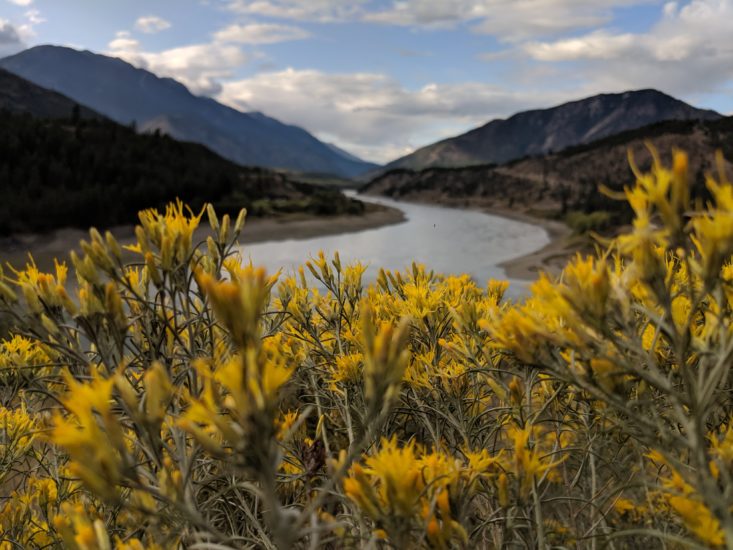
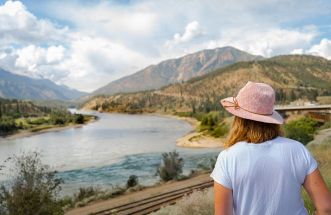
Located at the confluence of the Fraser River and its largest tributary, the Thompson River, Lytton has a dry climate with sagebrush growing in the hills and sweeping mountain and river views. This area was originally known as “Kumsheen” or “Camchin” in the local Nlaka’pamux language, meaning “where the rivers meet” and has been inhabited by the Nlaka’pamux people since time immemorial. In 1858, gold was discovered in the Nicomen River (ten miles north-east of Lytton, which was known at that time as “The Forks”). The Lytton First Nation figure prominently in the history of the Fraser Canyon Gold Rush (1858-1860) and of the associated Fraser Canyon War (1858). At Lytton, then still called Camchin, leaders of the miners’ regiments from Yale met with the chiefs of the Nlaka’pamux to parley an end to the war. While other chiefs argued for annihilation of the outsiders, the Kumsheen Chief Spintlum (Cxpentlm, aka David Spintlum) argued for peace, resulting in a series of six treaties known as the Snyder Treaties, which are lost to history.
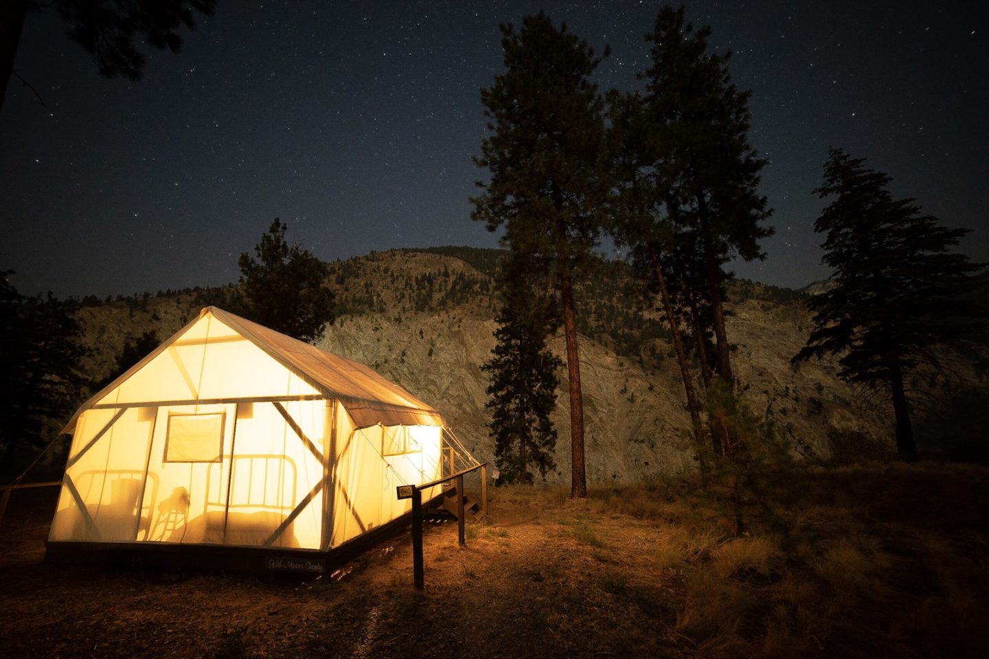
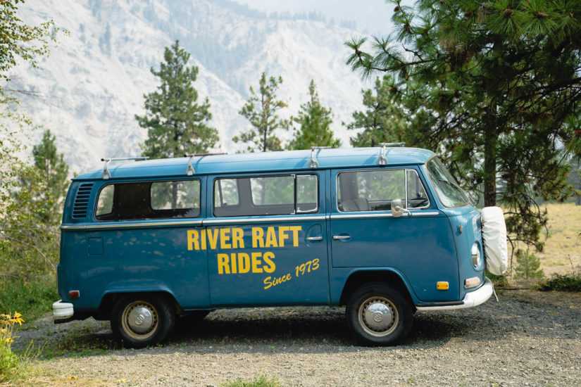
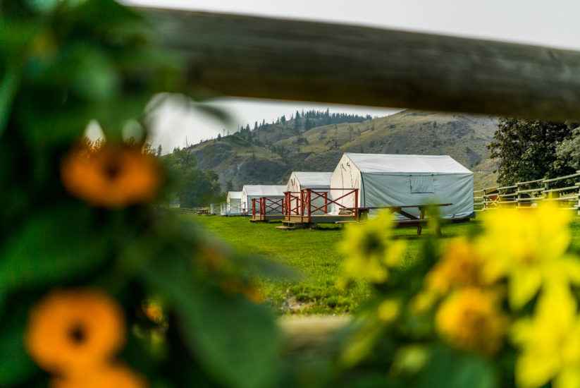
- “Whitewater Rafting Capital of Canada” with several world-class rafting companies navigating the local rapids. Raft the Thompson and stay in one of Kumsheen Rafting Resort’s gold rush themed glamping tents.
Please note that the town of Lytton was devastated by wildfires in 2021 and there is currently no stopping here, however, nearby businesses such as Kumsheen Rafting Resort are still open. As this community begins to rebuild, please be respectful and remember that wildfire safety is a shared responsibility. Visit our Know Before You Go page for more information.
Speculators first came to this area during the gold rush when the town was known as Cook’s Ferry. It is here that Cook and Kimble built a rope ferry across the Thompson River to transport the influx of prospectors; earning the community the name of Cook’s Ferry (the local First Nation Band carry this name today). In 1864 the ferry was replaced with a bridge built by Thomas Spence during the construction of the Cariboo Waggon Road from Yale to Barkerville Historic Town & Park. Surrounded by sagebrush and a unique landscape, Spences Bridge has become famous for its agricultural farm products and world-class steelhead fishing.
- There are many opportunities for fishing and whitewater rafting on the Thompson and Nicola rivers. The Spences Bridge stretch of the Thompson River is also a world-renowned location for steelhead trout and salmon fishing.
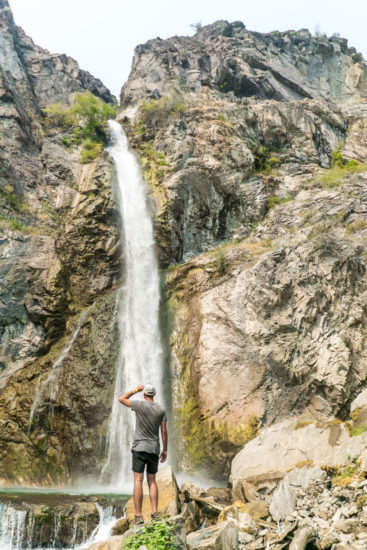
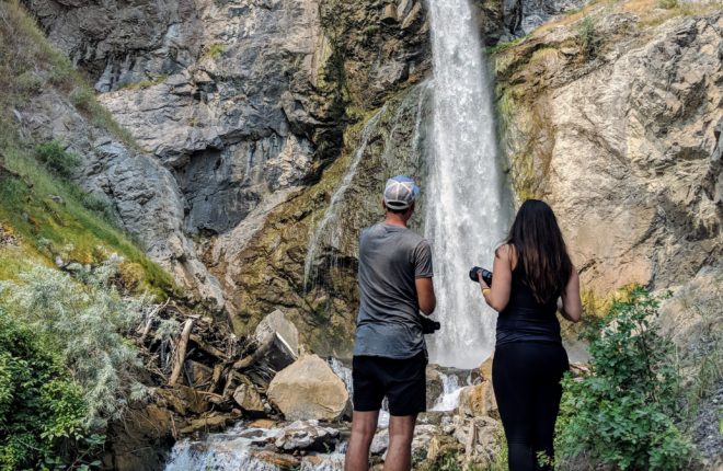
- Murray Creek Falls is another great place to explore. The trailhead is off the Trans Canada Hwy, west of Spences Bridge, near the Thompson River Bridge. Vital to the pioneers that settled here for power and water, Murray Creek Falls is named after early settler and orchardist, John Murray. This short hike is an ideal way to spend a sunny afternoon.
- Visit Golden Pan Provincial Park for a nice overnight stay and a great place to swim, fish, or just hang out with your friends and family.
- Locally grown vegetables and fruits are sold at stalls beside the highway, in town, and at wayside shops and make for a great stop.
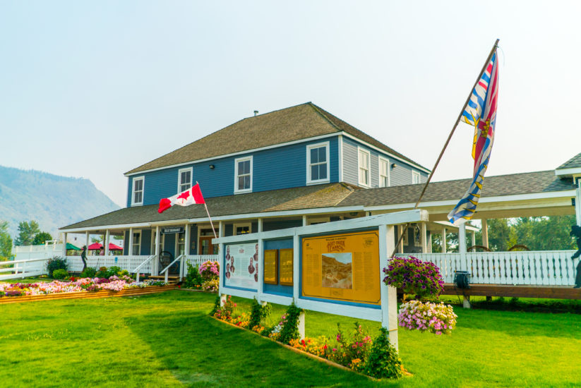
- Stop in at the Historic Widow Smith Packing House and enjoy some home cooked food and if your lucky you might catch some live music.
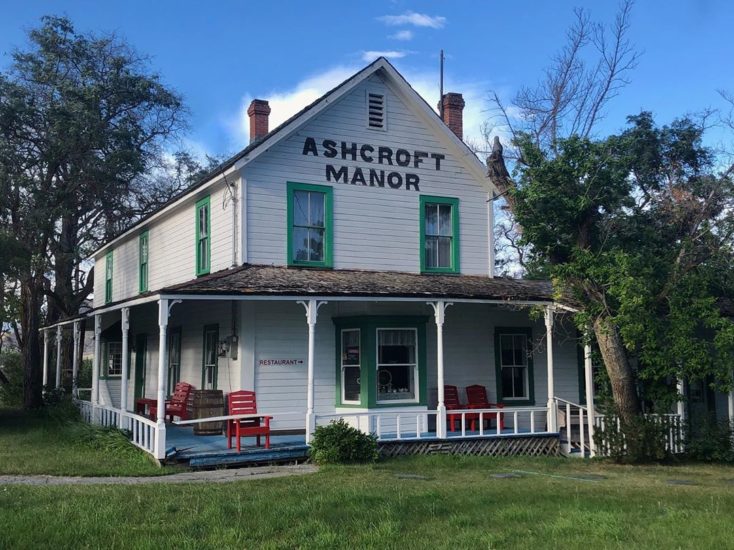
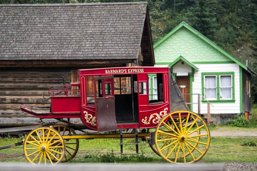
Part of Nlaka’pamux (Ing-la-kap-ma) territory, the Indigenous people living in the area in the past and still today, rely on the bounty of fish in the Thompson River to sustain their communities. In the 1880s, Ashcroft became a gold rush teeming transfer point where freight and mining supplies were unloaded on the Canadian Pacific railcars and hauled north to the Cariboo goldfields. With the influx of people business grew, and by 1887, the BC Express Company (a stagecoach line in Yale) relocated to Ashcroft, where it remained for 35 years. Farming and ranching were also vital to the growth of the community, and in the early 1900s settlers of Ashcroft discovered the rich volcanic soil on the benches between the hills and the desert sun were extremely fertile, producing large quantities of produce such as tomatoes and potatoes. Today, Ashcroft is a desert haven located in the stunning sagebrush-covered Thompson River Valley with a quaint and historic downtown that offers an escape from the hustle and bustle of city life. “Wellness Awaits You” in Ashcroft.
- Visit the Ashcroft Museum, housed in the town’s 1917 post office, with exhibits on gold rush history, the railway, ranching, mining, farming, fossil exhibits, Chinese and First Nations history and notorious events, such as the BX Express Coach robbery of 1890 by Martin Van Buren Rowland.
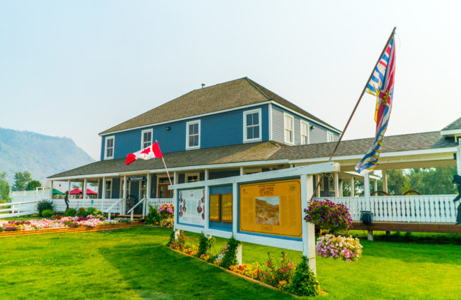
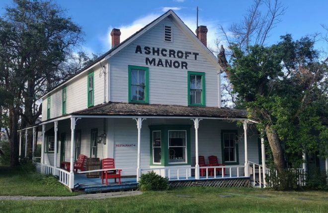
- The Ashcroft Manor was a popular stopover for travellers heading north to the goldfields in the 1800s and later the district’s first courthouse; then a teahouse, museum and art gallery. [note it is temporarily closed]
- Be sure to browse the local farmers market, stop by Desert Hills Ranch, check out the Heritage Place Park and stroll the quaint streets and view the many beautiful mosaics found throughout the community.
- Ashcroft boasts one of the driest climates in all of Canada where summers are warm and winters are mild. In the spring you can witness the cactus bloom along the sagebrush filled hillsides.
- Nearby Sundance Guest Ranch offers horseback riding and all inclusive guest ranch stays.
- Ashcroft is surrounded by an amazing array of Provincial Parks and Ecological Reserves. Outdoor activities are also plentiful such as mountain biking, hiking, geocaching and bird watching – the diversity of migratory birds is hard to match.
Set in a dramatic desert landscape and ideally located at the junction of Highways 1 and 97. Cache Creek has been a popular stopover point for travellers since the Gold Rush in the 1860s where the town acted as an important supply point. In the heart of Gold Country, nestled along the Bonaparte River, you will find accommodations, camping, vehicle services, restaurants, gift shops and supplies. Cache Creek is an ideal base for some of the best rock hounding in British Columbia, canoeing, horseback riding, fishing and hiking through dry grasslands and dramatic desert landscapes.
- Dip your toes in the Thompson River at Juniper Beach Provincial Park set in a scenic desert landscape containing sagebrush, prickly pear cactus and juniper.
- Learn about local Secwépemc (shi-huep-muh-k) culture and history and experience how prospectors and pioneers lived back in the day with a visit to nearby Historic Hat Creek.
- Try geocaching with the Gold Country GeoTourism Program that will guide you to gold rush themed caches and reward your perseverance.
- After exploring the area, indulge in a freshly baked pastry or sandwich from the local bakery or stock up on locally grown produce at one of the farm markets – Desert Hills Farm Market and Horsting’s Farmers Market are two of the largest.
- Check out nearby McAbee Fossil Beds Heritage Site that has Bonaparte Indian Band members there to greet visitors, show them around the site on the newly constructed trails, explain its history and answer questions.
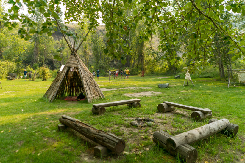
Ideally located at the junction of Highways 97 and 99, explore the original buildings used by gold rush travellers of the 1860s at one of the few original Cariboo waggon roadhouses still open to the public. Hat Creek House was established in 1861 by former Hudson’s Bay Company trader Donald McLean. What began as a small log stopping house later became a two-storied structure, with a west wing being added in 1901. Long before fur traders, Gold Rush miners, ranchers and settlers arrived in this valley, people of the Shuswap Nation followed a nomadic lifestyle here for thousands of years. Local Stuctwesemc (“Stluck-TOW-uhsen”) people from the Bonaparte Reserve have reconstructed traditional shelters, hunting and fishing gear, cook pits, and many other items you would find in a Shuswap Village and Indigenous Interpretation Center. It is the last remaining roadhouse of its type and one of the largest ever known along the Cariboo Wagon Road. Located on 345 acres of farm and rangeland, Historic Hat Creek has 20 historic buildings dating back to 1861, and Secwepemc (Bonaparte Indian Band) prehistoric archeological sites. The buildings stand as they did in 1901; some were built as early as 1860. Between 1885 and 1905 they witnesses the busiest era of transportation along the Road, serving the needs of freight wagons and passengers of the B.C. Express line (The “BX”).
- Stroll along the same dirt road that the waggon trains and miners travelled and stop in at the historic roadhouse, where interpreters dressed in period clothing will take you on a guided tour of a bygone era.
- Enjoy a stagecoach ride along beautiful Hat Creek to the Secwepemc (Shuswap) Village, where interpretive guides share a
glimpse into their history and living cultural traditions. - Try your luck in gold panning or archery, browse the giftshop and eat a delicious lunch at the onsite café.
- Spend the night in one of their covered wagons, camp in a miner tent or stay in one of the self-contained cabins located right in the historic site.
- Take a guided tour of the old rooms to reveal an intriguing history of the personalities who operated the ranch and traveled through it on the Cariboo Wagon Road.