Travel Info
- Routes
- Trans-Canada Hwy/BC-1 E
- Distance
- ~ 110 km / 68 miles
- Suggested Trip Time
- 1-3 Days
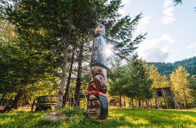
Stops on this Leg of the Gold Rush Trail
Human history in the Fraser Canyon dates back to over 9000 years ago.
Indigenous people have lived along this mighty river since time immemorial, travelling its waters and depending on the river’s abundance for food, transport, and trade, long before Simon Fraser chartered this river. In 1808 Simon Fraser travelled down the Fraser River, through treacherous portions of the river which now bears his name. He described one particular gorge as “the gates of hell,” after he and his men inched their way along its cliffs using rope ladders made by their Indigenous guides. This section of the Fraser River still goes by the name “Hell’s Gate.” The Fraser Gold Rush began in 1858 after gold was discovered on the Thompson River in British Columbia at its confluence with the Nicoamen River a few miles upstream from the Thompson’s confluence with the Fraser River at present-day Lytton. The rush that overtook the region was centred on the Fraser Canyon from around Hope and Yale to Pavilion and Fountain, just north of Lillooet. In response to the massive influx of miners, many prepared to disrespect local customers or even kill to get to the gold, the Nlaka’pamux people began to fight back beginning the Canyon War of 1858. A blockade of the river by the Nlaka’pamux Nation forced miners off the Fraser River Banks and, thanks to the peace negotiations by Chief Spintlum, an all-out war was avoided. Though the rush was largely over by 1927, miners from the boom spread out and found a sequence of other goldfields throughout the British Columbia Interior and North, most famously the Cariboo Gold Rush. The major influx of prospectors in the Fraser Canyon has forever shaped the regions’ culture, landscapes and collective memory.
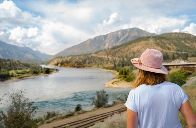
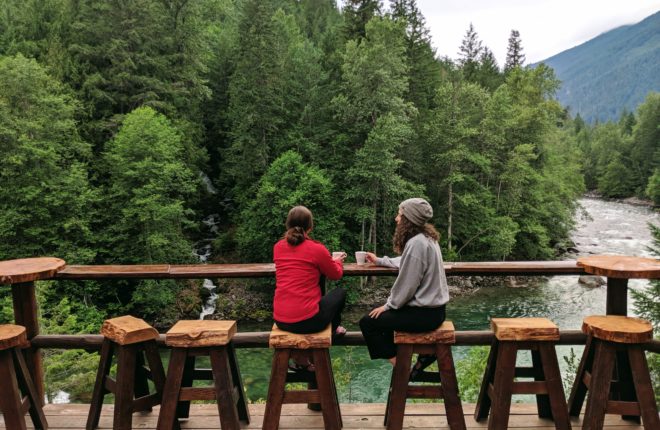
The Fraser Canyon is one of BC’s most scenic drives.
As you near the end of the Fraser Valley in Hope, the highway splits into two main routes north. These days, most people take the Coquihalla, but in the past, Highway 1 through the Fraser Canyon was the main route into Central and Northern British Columbia. Today, driving through the Fraser Canyon might be the road less travelled, but it is certainly one of BC’s most scenic drives, offering stunning vistas, trails and points of interest along the entire canyon. The mighty river below and the path of the Canadian Pacific Railway make this route well worth it. Travel the Fraser Canyon, and you will find year-round exploration opportunities and chances to learn more about the history of the area that has been well preserved in multiple historic points of interest and Indigenous tourism experiences that lie along this portion of the Gold Rush Trail.
For 10,000 years, Hope’s place at the confluence of the Fraser and Coquihalla rivers has made it a natural stopping point and meeting place for the Stó:lō (STOH-lo) Nation. European settlement began in earnest following Simon Fraser’s 1808 journey down the Fraser River and the Hudson Bay Company’s 1848 establishment of Fort Hope. When the Fraser River Gold Rush started in 1858, Hope enjoyed prominence as a gateway to the riches of the Fraser and, later, the Cariboo gold fields. Hope is nestled between the Coast Mountain Range and the Cascade Mountain Range and remains a gateway to the beauty of British Columbia’s interior. Today, visitors can travel north on Highway 1 along the Gold Rush Trail to closely follow the historic Cariboo Waggon Road as they wind their way through Sto:lo and Nlaka’pamux territory, past historic gold claims, and along the Fraser River which arguably gave birth to modern British Columbia.
- Hope has over a hundred documented trails all with varying degrees of difficulty. You can choose an easy, family-friendly hike to Flood Falls or try a more strenuous hike up Needle Peak. Regardless of your experience, there is a hike for you!
- Follow in the footsteps of First Nations and European fur traders as you hike the Hudson Bay Company trail. This 74 km/46 mi 168-year-old trail crosses the Cascade Mountains from Hope to Otter Lake (Tulameen).
- Learn about Hope’s culture and history by visiting the museum, art gallery or Japanese Friendship Garden. Grab a coffee and stroll through town and view the impressive 80+ chainsaw carvings and see first hand why Hope is referred to as the Chainsaw Capital.
- Ski or go snowshoeing in Manning Park, Needle Peak, Zoa Peak, Bombtram Mountain, and the Flatiron.
- Visit the Christ Church National Historic Site which is a fine example of Anglican parish church architecture in the Gothic Revival style and it is one of the best-preserved churches in Western Canada.
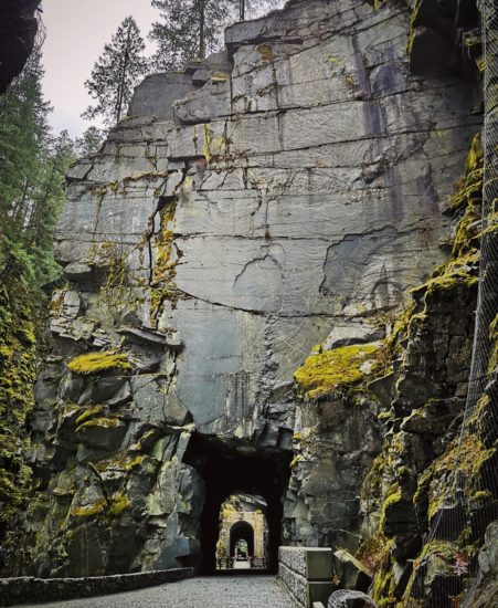
- Visit the Othello tunnels that are part of a rail trail through Coquihalla Canyon Provincial Park The tunnels and bridges lead right up to and over the cliffs, with boiling cataracts below. We recommend to visit here during shoulder season.
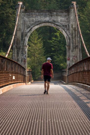
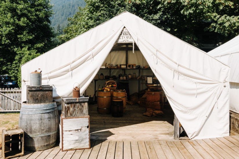
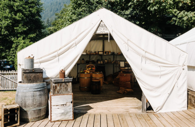
Originally established in 1848 as a Hudson’s Bay Trading Post, the small town of Yale grew to an estimated 30,000 people during the 1858 gold rush; then the largest city north of San Francisco and west of Chicago. The Chinese were among the earliest new arrivals to Yale, beginning with the Fraser River Gold Rush in 1858. Yale’s Chinatown was situated at the east end of town and was self sufficient with its own merchants, physicians, commercial establishments and cultural and political societies. In the 1860s, with the construction of the Cariboo Waggon Road, Yale became the terminus for one of the largest sternwheeler routes in North America. As well, in 1863, the Alexandra Bridge was built and connected the Cariboo Waggon Road and Fort Yale to south of the Cariboo Gold Fields. During the 1880’s Yale was the construction headquarters of the Canadian Pacific Railway.
- Explore the Yale Historic Site and Museum a living history ‘Tent City’ that takes you back to the early days of the 1858 Fraser River Gold Rush. Learn more in the museum about Chinese and Indigenous history in the area. Check out Creighton House, the tent city and the historic Saint John the Divine (1863), one of the oldest surviving churches in BC.
- Enjoy comforting home style meals in a charming atmosphere at the Ward Tea House. The patio is absolutely beautiful! If you have time, stay the night at the Jonny Ward Guest House, the original 1880s family home of Johnny Ward full of period furnishings, a claw foot tub and a lovely covered porch.
- Test your luck panning for gold at the Yale Public Panning reserve, one of the best free gold panning reserves in BC. Pick up your gold panning supplies at Barry’s Trading Post.
- Hikers can head out on the 5 km/3.1 mi Spirit Caves Trail for a three-hour hike with rewarding views of the Fraser River Canyon and Cascade Mountains. The trailhead is located just west of Yale on Highway 1 opposite the historic Pioneer Cemetery established in 1858.
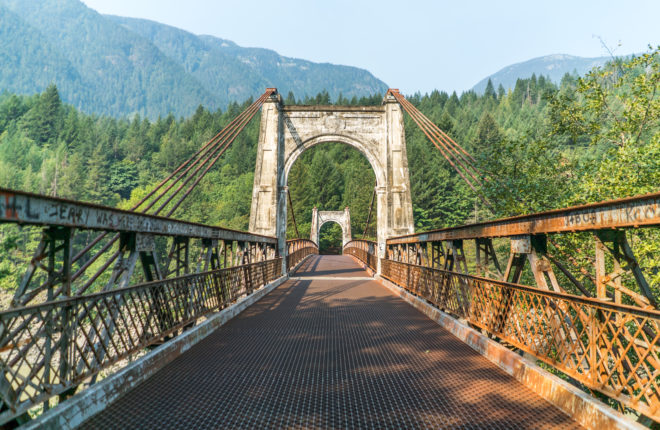
Declared the “eighth wonder of the world” when it was completed in 1865, the waggon road played a key role in the gold rush economy of the 1860s, and in the development of the new colony of British Columbia. When arriving at Alexandra Bridge Provincial Park in the Fraser Canyon, take a short walk to the Alexandra Bridge perched over the spectacular Fraser River. Originally constructed in 1863, the bridge was part of the Cariboo Waggon Road that connected Fort Yale and the south to the Cariboo Gold Fields. The area has been used and inhabited by First Nations for over 9,500 years. The first European visit to this area did not occur until Simon Fraser’s expedition passed through the region in 1808. The first permanent trail, the Anderson Brigade trail, was established in 1848 and subsequently, the original bridge was constructed in 1861 by Joseph W. Trutch and named after Princess Alexandra of Wales. To recover the $45,000 construction cost for the 90 m bridge, a toll of $7.40 per ton was charged. Today a second bridge, built in 1926, sits on the site of the original bridge which was dismantled in 1912. Just upriver of the bridge, there was once an important village called Kequeloose that was supported by the Fraser River’s abundance of salmon. From the bridge, you can see Nlaka’pamux fishing sites or fishing rocks along the rocky walls of the canyon that have been used for thousands of years to catch salmon.
- This site is a great place to stop for a picnic and go for a walk to the historic bridge along a trail through the forest. Take time to marvel at the Fraser River while on the bridge!
- If you are interested in a historic hike, shortly after passing Alexandra Bridge Provincial Park, look for the Alexandra Lodge on your right and continue on another 400 m to the Tikwalus Heritage Trail parking and trail information kiosk. The Nlaka’pamux (Thompson) First Nation have traveled this trail through the Fraser Canyon for thousands of years. It was used for hunting, trapping, plant gathering, and as a safe travel route that bypassed the sheer canyon walls at Hell’s Gate and during the fur trade was used by the Hudson’s Bay Company.
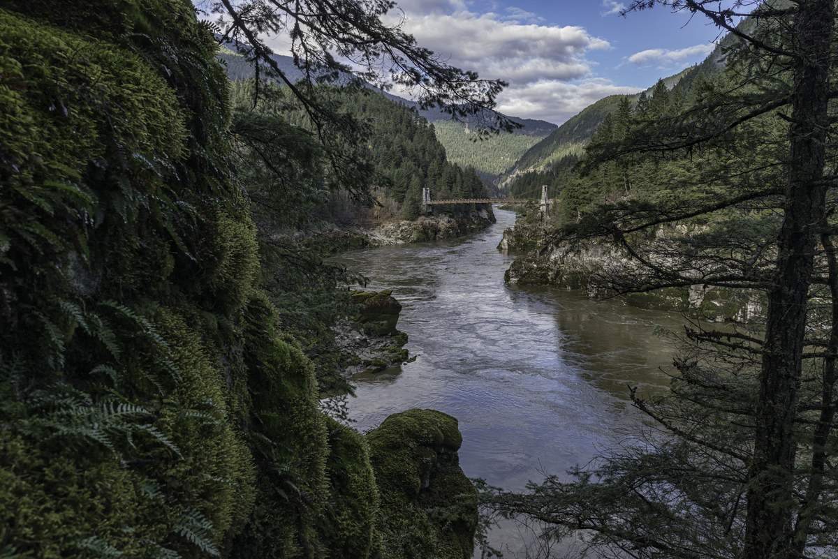
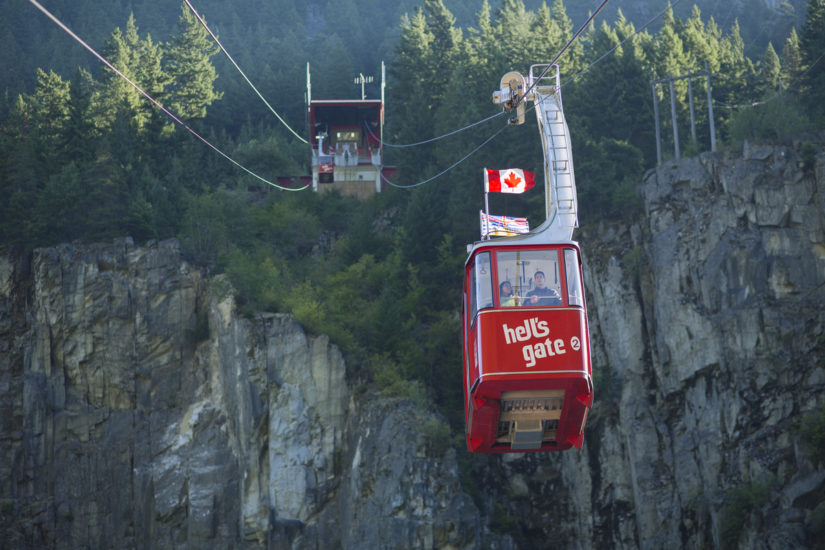
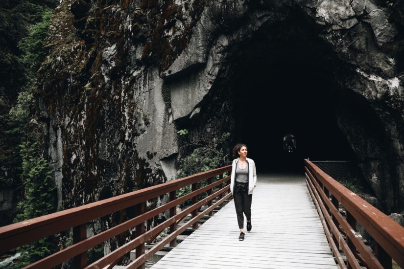
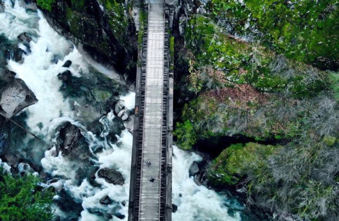
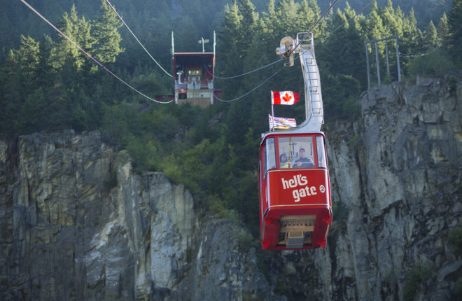
Less than 2.5 hours from Vancouver is the deepest, most dangerous and fastest-moving section of the Fraser River; looking up you will see sheer rock faces and down below you can witness the river smashing its way through a constricted channel. For centuries, this narrow passage has been a popular fishing ground for the Nlaka’pamux Nation. Simon Fraser, the first European to explore the region described the gorge as “the gates of hell,” after he and his men inched their way along its cliffs in 1808 using rope ladders made by their Indigenous guides. Today, Hell’s Gate is one of the province’s most unique and popular draws with the site being fully accessible and pet friendly.
- Experience the exhilaration of crossing the Fraser Canyon in the Hell’s Gate Airtram. It is one of the steepest fully suspended trams in North America. Once aboard the tram, you are leaving the Cascade Mountain range and docking at the foot of the Coast Pacific Mountain Range.
- On the other side you can explore the gift shop, eat lunch and have an ice cream.
- While visiting, marvel at the mighty Fraser River from the suspension bridge or the many observation decks. Water levels are known to rise up to 100 feet in the spring reaching record heights of 209 feet deep. That is over 200,000,000 gallons of water every minute raging through a narrow rock canyon just over 100 feet wide.
- Learn about local history and spawning salmon in the educational center. Hell’s Gate is home to massive fishways constructed to assist the millions of salmon that pass through annually en route to their spawning grounds.
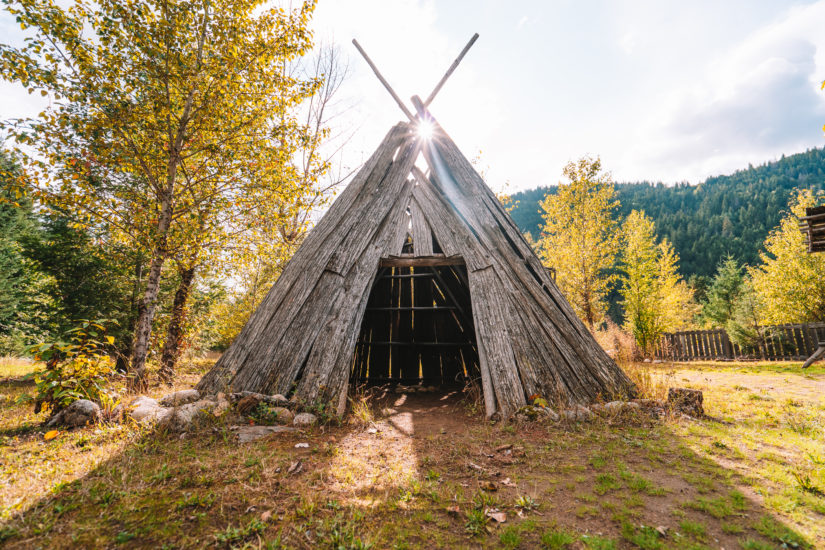
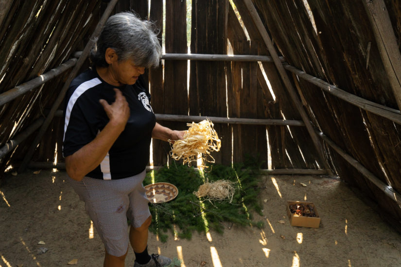
Tuckkwiowhum (Tuck-we-ohm) is located just 5 km south of Boston Bar and is a spectacular Nlaka’pamux (ing-khla-kap-muh) heritage site and village. The area was given its name by local Nlaka’pamux people, which translates to “great berry picking place” in English. The rolling hills still boast lush forests with wild huckleberries, blueberries and medicinal plants that are vital to the indigenous people living in the Fraser Canyon. Tuckkwiowhum Heritage Village was inspired by the local First Nations desire to preserve and share the deep spiritual connection to the land and the teachings of the Nlaka’pamux people. Whether you’re looking for a peaceful weekend getaway, a quick stop on the way through the canyon, or to immerse yourself in the rich lifestyle and culture, you’ll find what you’re looking for at Tuckkwiowhum. Be sure to call (604) 867-9107 and book a guided tour in advance.
- The site offers guests an opportunity to experience the Nlaka’pamux village lifestyle before the arrival of European culture, including a subterranean pit house, summer lodges, smokehouse and replicas of actual pictographs found in Nlaka’pamux territory.
- Traditional story-telling sessions, special events and courses are available as well as history lessons of the Fraser Canyon and the Nlaka’pamux people.
- Camp at the neighbouring Tuckkwiowhum Campground and have the opportunity to view the beautiful railroad bridge circa 1948 which crosses above the campground’s entrance road.
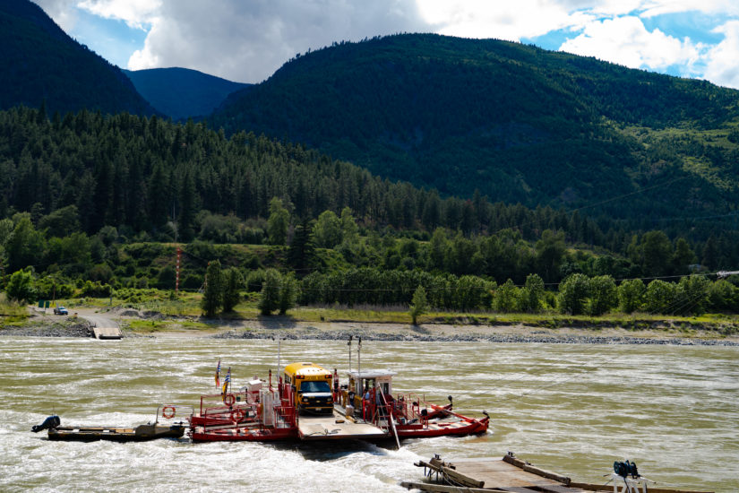
From Hell’s Gate travel north about 10 minutes on Highway 1 and you will arrive in Boston Bar, a town that got its name from the large number of gold-seeking Americans from Boston which local Nlaka’pamux (Ing-la-kap-ma) First Nations called the “Boston Men”. The original settlement in this area was the First Nations’ village of Koiaum, located on the west side of the Fraser River. Directly across the Fraser River from Boston Bar is North Bend, which only became accessible by road in 1986, when a bridge was built to replace the aerial ferry. Boston Bar is the gateway to the Nahatlatch River Valley, Skuzzy Creek, Anderson Creek and North Bend area.
- Experience Nlaka’pamux culture at Tuckkwiowhum (Tuck-we-ohm) Heritage Site located 5 km/3.1 mi south of Boston Bar.
- An excellent base camp into Mehatl Creek Provincial Park where you can escape and enjoy the beauty of scenic alpine ridges, lush sub-alpine meadow, and pristine old-growth forests – all in perfect silence.
- Head west on Chaumox Road to explore the pastoral Nahatlatch River Valley and Provincial Park, which features one of British Columbia’s most exciting stretches of whitewater for rafting and kayaking.
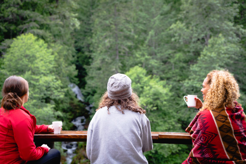
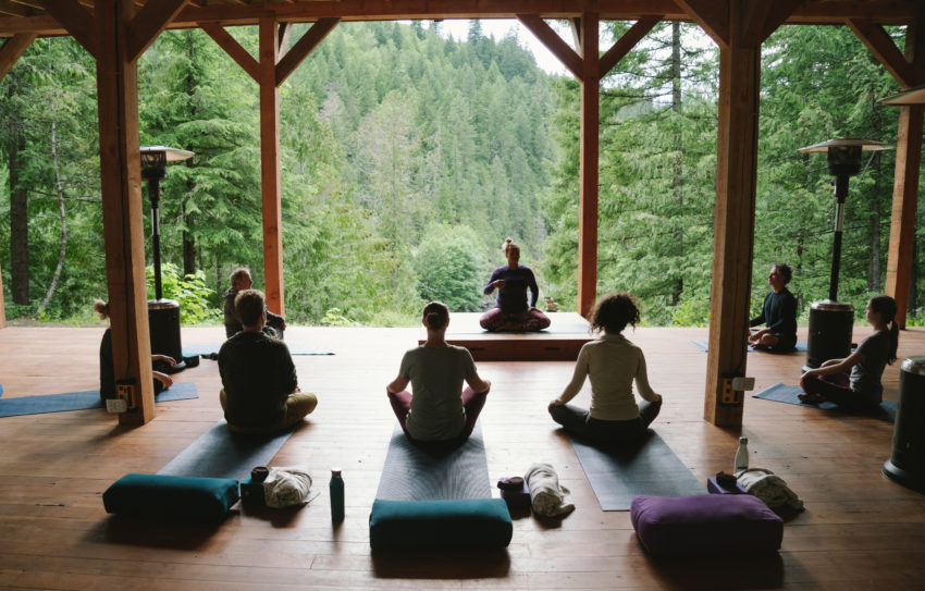
- Go rafting, stay in a glamping tent or enroll in a yoga retreat while reconnecting with nature by immersing yourself in the natural surroundings at REO Rafting Resort.
-
Enjoy a picnic at the refurbished old aerial tram, which used to connect the towns of Boston Bar and North Bend, which sits prominently in Frances Harrington Park on Highway 1.
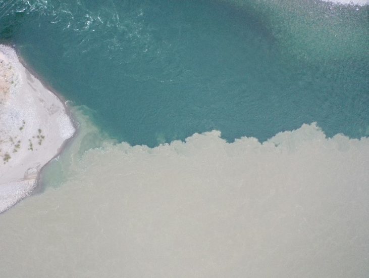
Located at the confluence of the Fraser River and its largest tributary, the Thompson River, Lytton has a dry climate with sagebrush growing in the hills and sweeping mountain and river views. This area was originally known as “Kumsheen” or “Camchin” in the local Nlaka’pamux language, meaning “where the rivers meet” and has been inhabited by the Nlaka’pamux people since time immemorial. In 1858, gold was discovered in the Nicomen River (ten miles north-east of Lytton, which was known at that time as “The Forks”). The Lytton First Nation figure prominently in the history of the Fraser Canyon Gold Rush (1858-1860) and of the associated Fraser Canyon War (1858). At Lytton, then still called Camchin, leaders of the miners’ regiments from Yale met with the chiefs of the Nlaka’pamux to parley an end to the war. While other chiefs argued for annihilation of the outsiders, the Kumsheen Chief Spintlum (Cxpentlm, aka David Spintlum) argued for peace, resulting in a series of six treaties known as the Snyder Treaties, which are lost to history.
- “Whitewater Rafting Capital of Canada” with several world-class rafting companies navigating the local rapids. Raft the Thompson and stay in one of Kumsheen Rafting Resort’s gold rush themed glamping tents.
Please note that the town of Lytton was devastated by wildfires in 2021 and there is currently no stopping here, however, nearby businesses such as Kumsheen Rafting Resort are still open. As this community begins to rebuild, please be respectful and remember that wildfire safety is a shared responsibility. Visit our Know Before You Go page for more information.