Travel Info
- Routes
- Highway 12 and 99
- Distance
- ~ 141 km / 88 miles
- Suggested Trip Time
- 1-2 days
STOPS ON THIS LEG OF THE GOLD RUSH TRAIL
travel highway 12 through towering mountains along the fraser river
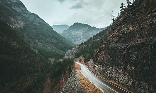
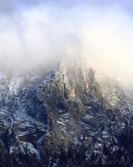
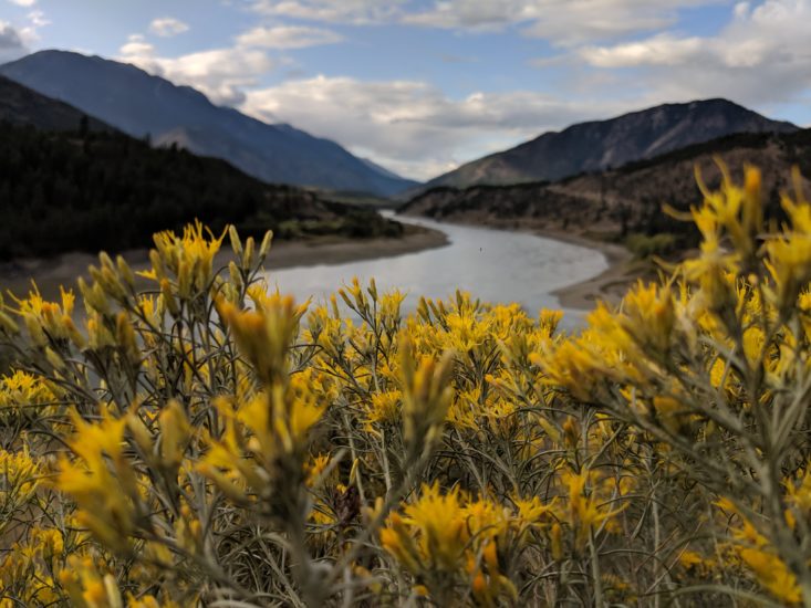
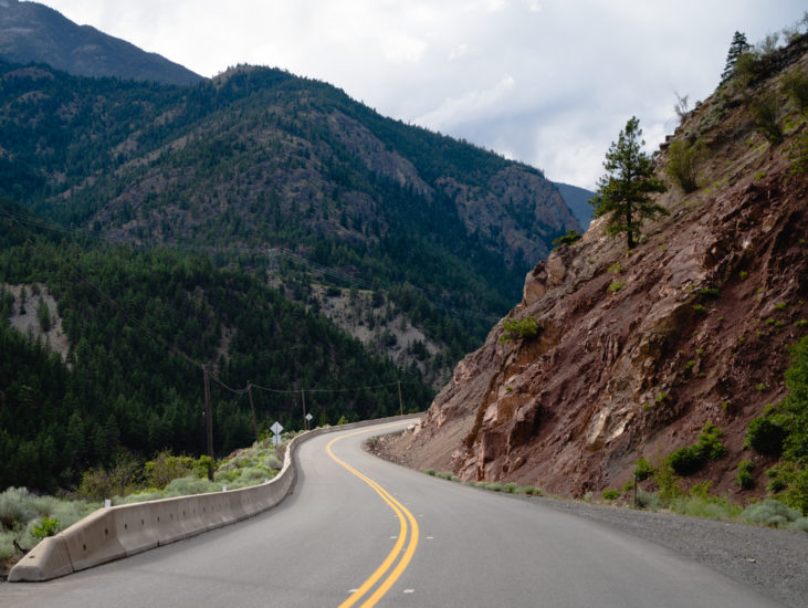
From Lytton, there is the option to drive north to Lillooet, or northwest through picturesque grasslands, canyons and mountains via Spences Bridge. Travelling on Highway 12 to Lillooet the landscape is dramatic and makes for an incredible road trip. Traditionally, the gathering site of the Nlaka’pamux First Nation, today Lytton is known as the “White Water Rafting Capital of Canada,” and is a hub for hiking, camping, and geocaching enthusiasts. As you head to Lillooet you will enter into St’át’imc (stat-lee-um) traditional territory and mountainous and rugged terrain adored by adventure seekers from all over the world where the landscape is wild, rocky and steep, and roads are carved out of mountainsides. When taking this northeast route, Highway 99 takes you past Marble Canyon Provincial Park and Pavilion to Historic Hat Creek Ranch an original 1860s roadhouse and Secwepemc (shi-huep-muh-k) cultural site.
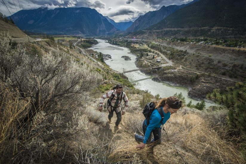
Located at the confluence of the Fraser River and its largest tributary, the Thompson River, Lytton has a dry climate with sagebrush growing in the hills and sweeping mountain and river views. This area was originally known as “Kumsheen” or “Camchin” in the local Nlaka’pamux language, meaning “where the rivers meet” and has been inhabited by the Nlaka’pamux people since time immemorial. In 1858, gold was discovered in the Nicomen River (ten miles north-east of Lytton, which was known at that time as “The Forks”). The Lytton First Nation figure prominently in the history of the Fraser Canyon Gold Rush (1858-1860) and of the associated Fraser Canyon War (1858). At Lytton, then still called Camchin, leaders of the miners’ regiments from Yale met with the chiefs of the Nlaka’pamux to parley an end to the war. While other chiefs argued for annihilation of the outsiders, the Kumsheen Chief Spintlum (Cxpentlm, aka David Spintlum) argued for peace, resulting in a series of six treaties known as the Snyder Treaties, which are lost to history.
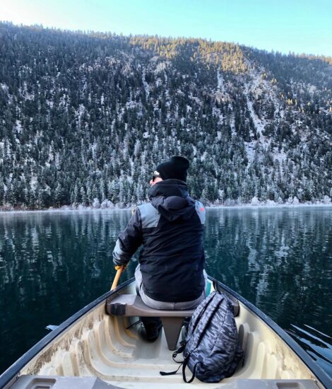
- “Whitewater Rafting Capital of Canada” with several world-class rafting companies navigating the local rapids. Raft the Thompson and stay in one of Kumsheen Rafting Resort’s gold rush themed glamping tents.
Please note that the town of Lytton was devastated by wildfires in 2021 and there is currently no stopping here, however, nearby businesses such as Kumsheen Rafting Resort are still open. As this community begins to rebuild, please be respectful and remember that wildfire safety is a shared responsibility. Visit our Know Before You Go page for more information.
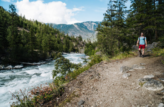
The Stein Valley Nlaka’pamux Heritage Park contains spectacular scenery and significant historic, cultural and spiritual value. ‘Stein’ comes from the Nlaka’pamux (ing-khla-kap-muh) word “Stagyn”, meaning ‘hidden place’, referring to the obscurity of this key watershed and the valley that has been important to First Nations for thousands of years for both sustenance and spirituality, as evidenced by a large number of pictographs still visible today. Due to its size and relative lack of disturbance the park is home to over 50 species of mammals and many varieties of birds and fish in its diverse ecosystem. Straddling the transition from the dry interior landscape to the wetter coastal mountains, the park protects the entire Stein River watershed with a user-maintained area, with 150 km/93.2 mi of hiking trails and routes, four cable crossings, a suspension bridge and several wilderness campgrounds. Whether stopping in for an easy day hike in the lower valley or trekking into the backcountry on a multi-night trip you will feel the spirit and the energy of this special place.
- Take the free Reaction Ferry across the Fraser River to the Stein Valley Nlaka’pamux Heritage Park. The Ferry is closed for periods in the spring due to high water. For current information about the Lytton Ferry please check the Drive BC website (click on Inland Ferry, click on or scroll down to Lytton Ferry, then click on Current Conditions and Events).
- From the trailhead parking lot, plan an easy-to-moderate hike to Asking Rock where there are local area petroglyphs. Please be respectful as this is a culturally important area to the Nlaka’pamux people. Do not touch or tamper with any pictographs, petroglyphs, or culturally modified trees when visiting the park.
- The park offers limited opportunities for easy day hikes (primarily in the lower valley) and extensive opportunities for multi-night backpacking trips over moderate to difficult terrain. With limited Ranger and Stein Valley Warden patrols, visitors must be self-sufficient and prepared for all eventualities.
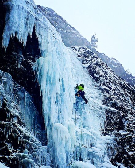
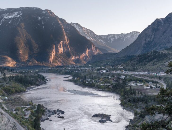
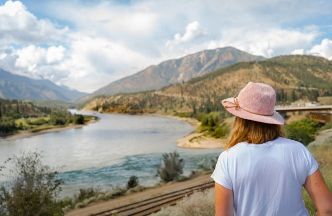
Lillooet is located at the foot of the Coast Mountain range with roads carved out of mountainsides and ever changing views of the Fraser River. The St’át’imc (STAH-tleum) Nation has called this area home for over 8,000 years, with the fertile valley still an ideal location for hunting, fishing and gathering. With the discovery of gold, Lillooet became “Mile 0” of the original Cariboo Waggon Road and one of the epicentres of the Fraser River Gold Rush. As one of the most important supply locations along the Gold Rush Trail, Lillooet grew quickly and by 1860, Lillooet’s burgeoning population was nearly 15,000 with lively saloons, shops and dwellings. It wasn’t just gold that attracted newcomers, the town also became the largest exporter of nephrite jade in the world. No matter the direction you’re coming from, the drive to Lillooet is guaranteed to be beautiful. Easy access to mountain biking, fishing, backpacking, and boating make Lillooet a perfect playground in spring, summer and fall, while winter boasts unprecedented ice climbing, heli-skiing and snowmobiling. For our history buffs, there is Lillooet’s Golden Miles of History Tour that is named for the wealth of gold dust mined from the downtown section of Main Street that also became the supply hub for the Cariboo Goldfields.
- Take in the local St’át’imc culture with a tour at Xwisten Experience Tours or roam the boardwalks and buy locally made botanical products at Splitrock Environmental.
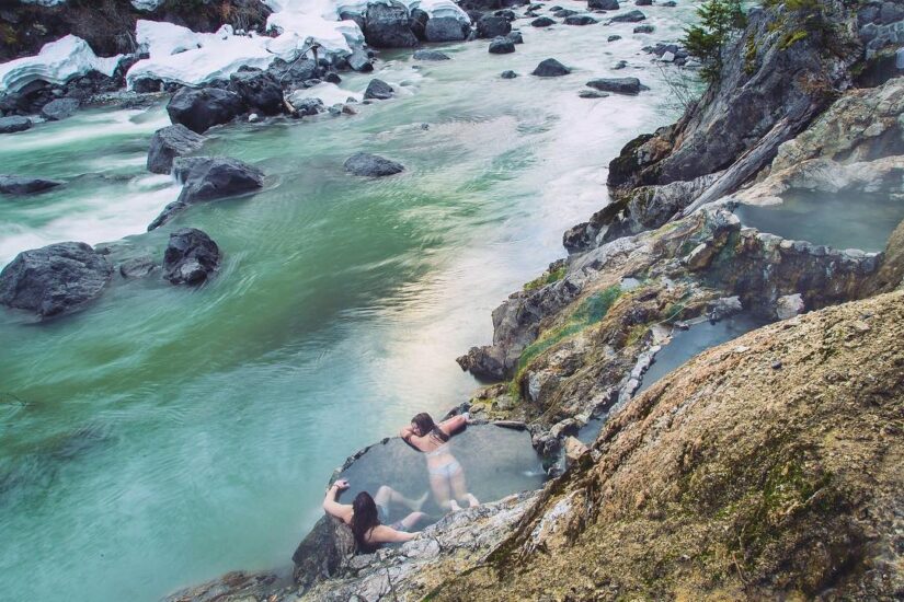
- Stop at the viewpoint overlooking the picturesque emerald-green waters of Seton Lake Reservoir and the surrounding Chilcotin Range. Near the viewpoint, you may be able to see evidence of kekulis, underground spectacular homes built by the interior Salish-speaking St’át’imc people inhabiting the area since time immemorial. A short, self-guided interpretive trail provides history of the Lillooet area.
- Lillooet’s geography, soil, hot summers and mild winters make this area one of Canada’s premier agricultural regions with anything from grapes, stone fruit to hops being grown in the area. Visit during July’s Apricot Tsaqwen Festival or in September for the annual Harvest Festival.
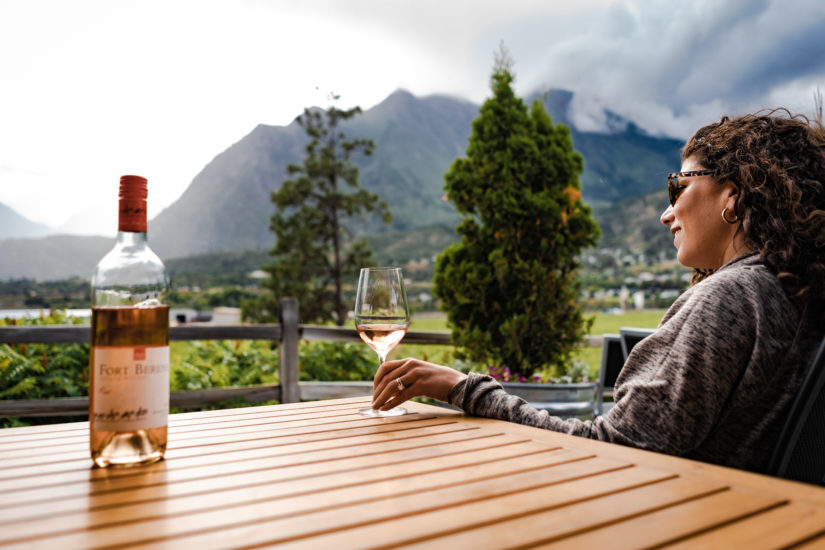
- A trip to Lillooet is not complete without a stop at the award-winning Fort Berens Estate Winery, or the Abundance Artisan Bakery with its fresh baked goods and delicious coffee.
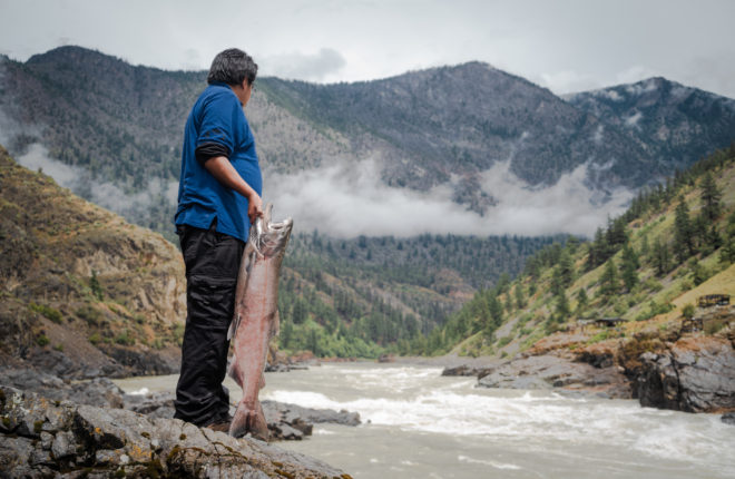
- Hire a guide and cast a line in the Fraser River for the dinosaur of the deep, the White Sturgeon. This protected species is the largest freshwater fish in North America.
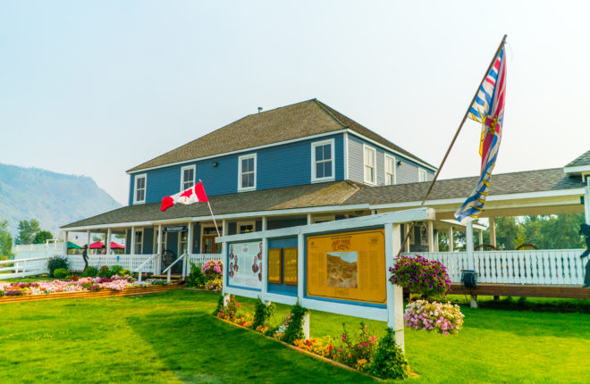
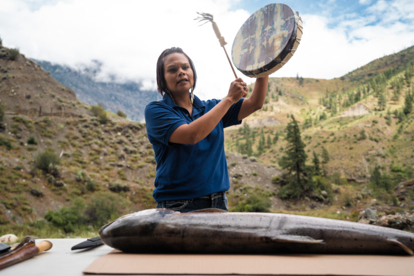
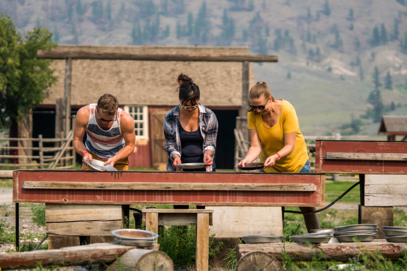
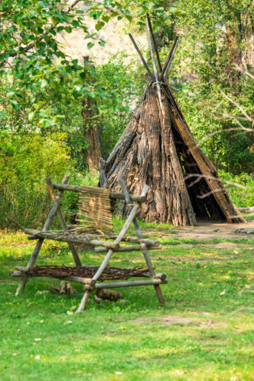
Ideally located at the junction of Highways 97 and 99, explore the original buildings used by gold rush travellers of the 1860s at one of the few original Cariboo waggon roadhouses still open to the public. Hat Creek House was established in 1861 by former Hudson’s Bay Company trader Donald McLean. What began as a small log stopping house later became a two-storied structure, with a west wing being added in 1901. Long before fur traders, Gold Rush miners, ranchers and settlers arrived in this valley, people of the Shuswap Nation followed a nomadic lifestyle here for thousands of years. Local Stuctwesemc (“Stluck-TOW-uhsen”) people from the Bonaparte Reserve have reconstructed traditional shelters, hunting and fishing gear, cook pits, and many other items you would find in a Shuswap Village and Indigenous Interpretation Center. It is the last remaining roadhouse of its type and one of the largest ever known along the Cariboo Wagon Road. Located on 345 acres of farm and rangeland, Historic Hat Creek has 20 historic buildings dating back to 1861, and Secwepemc (Bonaparte Indian Band) prehistoric archeological sites. The buildings stand as they did in 1901; some were built as early as 1860. Between 1885 and 1905 they witnesses the busiest era of transportation along the Road, serving the needs of freight wagons and passengers of the B.C. Express line (The “BX”).
- Stroll along the same dirt road that the waggon trains and miners travelled and stop in at the historic roadhouse, where interpreters dressed in period clothing will take you on a guided tour of a bygone era.
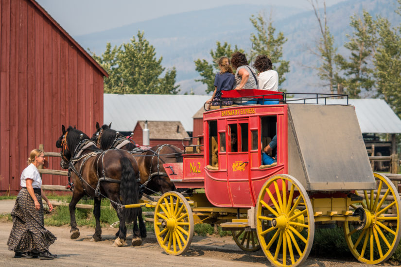
- Enjoy a stagecoach ride along beautiful Hat Creek to the Secwepemc (Shuswap) Village, where interpretive guides share a
glimpse into their history and living cultural traditions. - Try your luck in gold panning or archery, browse the giftshop and eat a delicious lunch at the onsite café.
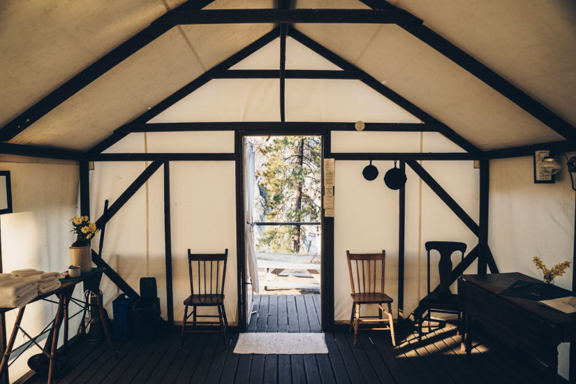
- Spend the night in one of their covered wagons, camp in a miner tent or stay in one of the self-contained cabins located right in the historic site.
- Take a guided tour of the old rooms to reveal an intriguing history of the personalities who operated the ranch and traveled through it on the Cariboo Wagon Road.